datasette-leaflet-geojson/README.md
# datasette-leaflet-geojson[](https://pypi.org/project/datasette-leaflet-geojson/)[](https://github.com/simonw/datasette-leaflet-geojson/releases)[](https://github.com/simonw/datasette-leaflet-geojson/actions?query=workflow%3ATest)[](https://github.com/simonw/datasette-leaflet-geojson/blob/main/LICENSE)Datasette plugin that replaces any GeoJSON column values with a Leaflet map## InstallationInstall this plugin in the same environment as Datasette.$ datasette install datasette-leaflet-geojson## UsageAny columns containing valid GeoJSON strings will have their contents replaced with a Leaflet map when they are displayed in the Datasette interface.## DemoYou can try this plugin out at https://calands.datasettes.com/calands/superunits_with_maps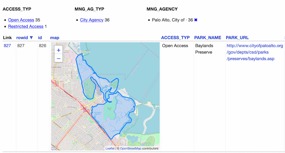## ConfigurationBy default this plugin displays maps for the first ten rows, and shows a "Click to load map" prompt for rows past the first ten.You can change this limit using the `default_maps_to_load` plugin configuration setting. Add this to your `metadata.json`:```json{"plugins": {"datasette-leaflet-geojson": {"default_maps_to_load": 20}}}```Then run Datasette with `datasette mydb.db -m metadata.json`.